
Finding Who Lives on an Eagle Mountain Street
Begin with the exact street address you have. Enter number, direction, street, street type, and city or location in the Utah County address search. If it finds a parcel, record the serial, property address, mailing address, lot, plat, phase, owner field, and tax area. Then open the parcel dashboard and its document rows. This order makes the street directory useful for property research without turning an owner field into a claim about every person who lives there.
Next, use the serial in the county map and recorder tools. Compare the highlighted parcel with the street name and lot shape. Read the latest conveyance deed, not just a trust deed, release, or correction. If a name matters, compare it with a voter status result or a second record that agrees on date, spouse, parcel, business, or case. For past occupants, switch to regional directories, newspapers, probate, and cemetery records.
- Search the address and save the parcel serial.
- Compare situs and mailing fields on the parcel card.
- Open GIS and click nearby parcels or the whole street segment.
- Read recorded entries by date, type, grantor, grantee, and legal description.
- Use voter, directory, city, and request channels only for their stated record role.
Read Eagle Mountain Address Fields
The county address form has a number, direction, street, street type, and city or location field. It offers all records and current-record choices. Try common suffix changes such as St and Street or Dr and Drive when a clean result does not appear. Test a subdivision or phase when a new street is not indexed as expected.
The parcel dashboard separates property or situs address from mailing address. The inspected sample for serial 34:707:0809 shows 9781 N Belle St as a property address, 1196 E Haviture Way as an alternate address, and a mailing line with Eagle Mountain and ZIP 84005. It also shows 0.707287 acres, Arrival Phase B, Plat 8, valuation years, tax rows, and a document table. An alternate address is a reason to preserve the serial, not a reason to merge unrelated records.
Review the county parcel-card sample when learning the fields a street directory search can expose. The county warns that a taxing description is not for legal documents, so use the recorded plat or deed for that purpose.
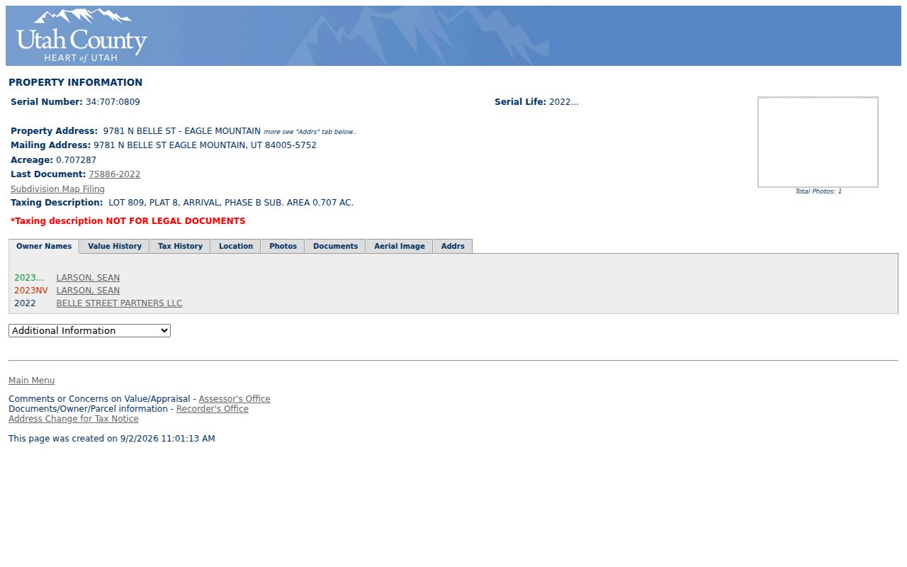
The card is a strong bridge from a street number to a parcel, but it still does not list nonowners or every household member.
- Situs
- The physical location of the parcel or building.
- Mailing address
- The tax-notice address, which can be elsewhere.
- Parcel serial
- The county key that joins map, tax, assessor, and recorder views.
- Plat
- A recorded map that organizes lots, phases, roads, and easements.
Eagle Mountain Search Fields
The Utah County owner form accepts a last-name, first-name, and middle-name style search. Its status controls include All Records, Current Records Only, and Never Valid Only. The address form is more useful for a whole street because it allows an address number, direction, street name, street type, and city or location.
| Field | Format or choice | Why it helps |
|---|---|---|
| Address Number | Street number | Starts an address-keyed search |
| Direction | Directional dropdown | Separates N, S, E, and W variants |
| Street | Street name | Finds a segment or parcel |
| Street Type | Street, Drive, Circle, Way, Lane, Avenue, Boulevard, Court, Parkway, Place, Terrace | Tests suffix variation |
| City/Location | Eagle Mountain or another indexed label | Bridges postal and municipal terms |
| Record status | All, current, or never valid | Separates active from older rows |
Open the official address form and note the query date. A street directory result is easier to reproduce when the exact spelling, suffix, city field, and status choice are saved.
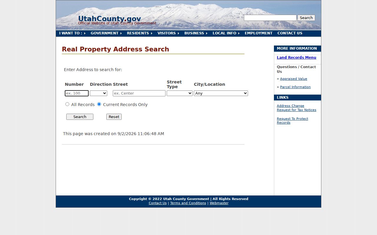
The address capture shows the county fields that a name-only search cannot replace.
The owner-search form adds a second way to test a person against county property records, with all, current, and never-valid choices.
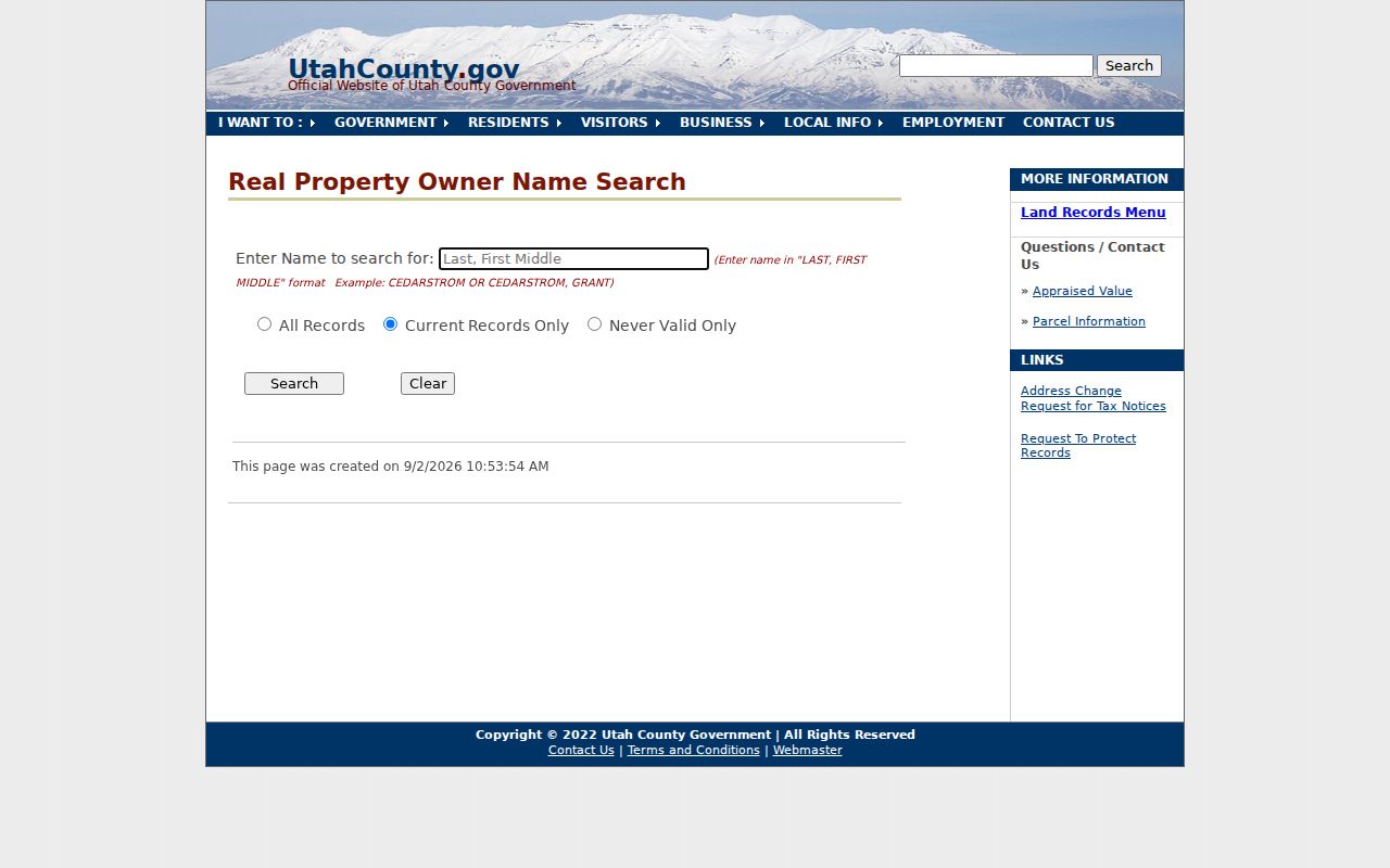
Owner search is a parcel lead. It does not establish that the named owner occupies the property.
Browse the Eagle Mountain Parcel Map
The Utah County Parcel Map is the street-browse tool. Type an address and select autocomplete. If several matches appear, choose the parcel and use Zoom To. The map also accepts owner text, a serial in several formats, a city selection, or a PLSS section, township, and range. Click the target, then pan along the street and record each parcel serial independently.
Layers can add aerial imagery, zoning, precinct or district context, and other county views. Three-dot controls expose legends and transparency. Measurement can note approximate separation, while deed-point and single-page map tools help preserve a research view. Historic Parcel accepts a date, but the historic view records when a parcel entered the online system, not when a deed was recorded.
Use the Utah County Parcel Map for geometry and context. It carries a reference-only warning, so confirm a transfer in the Recorder’s index and document image.
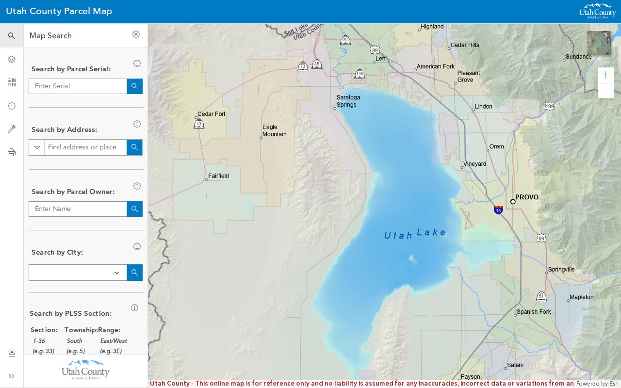
The GIS view is valuable for finding the next parcel, not for proving a boundary or household relationship.
Follow Documents Along a Street
A whole-street review requires one row per parcel. Save serial, situs, mailing line, subdivision, plat, phase, tax area, current owner field, and map date. Then open the parcel’s recorded-document rows. The sample table separates entry number, instrument date, recording date, type, grantor, grantee, and document link. It includes trust deeds, releases, correction-style rows, subdivision plats, and warranty deeds.
Use the latest conveyance deed to identify the preceding grantor. Search that seller as a grantee in an earlier period, using the legal description and serial when available. A deed can move title. A trust deed usually describes a security interest. A release can show satisfaction. An easement can name a nearby party without changing ownership. Keep those roles distinct in the street directory.
Open the county serial and entry cross-reference when a parcel card points to an entry number. This is the right bridge from a street record to the county’s instrument route.
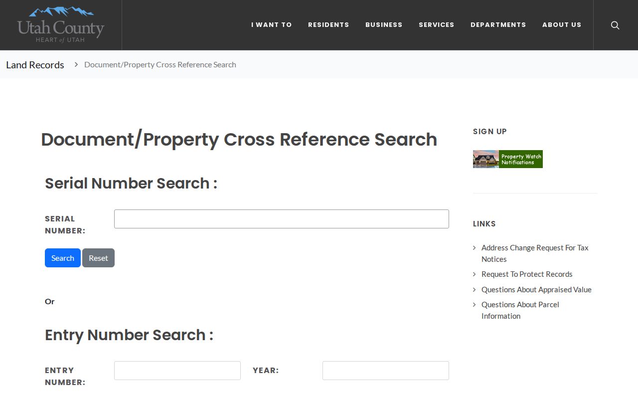
The cross-reference helps keep a street study tied to the parcel and entry, rather than only to a person’s name.
Use the Legal Description
If an address fails, search the subdivision, phase, lot, owner, or serial. Eagle Mountain’s phased development means a plat can be more stable than a street label. The sample parcel uses Arrival, Phase B, Plat 8, and Lot 809. Compare that text with the recorded plat before joining an alternate street number to the same parcel.
The Recorder says not every parcel has an address, some apartments have several, and cities assign addresses. Address changes may not reach assessor records promptly. That warning is a central street-directory rule. Record the street as printed, then preserve the legal description and serial as the continuity keys.
For a street-wide pass, work from a fixed cross street in both directions. Log undeveloped lots, common tracts, parcels across the road, gaps, and duplicate-looking numbers. The result is a repeatable parcel list, not a claim that every visible home has a public resident entry.
Permits Date Modern Streets
Eagle Mountain planning and building files can add an applicant, project, address, parcel, phase, inspection, or certificate-of-occupancy date. Current applications use city OpenGov routes. A complete public permit-by-address history was not located, so a searcher should use the portal for current material and send a narrow GRAMA request for an existing older file.
The city’s GRAMA form has a specific limit for residential building plans. It says plans are copyrighted, view-only in the Recorder’s Office for one year after certificate of occupancy, and then destroyed. A permit or meeting record may therefore survive when a plan copy does not. Ask for a permit number, application, inspection record, certificate, agenda, or development agreement by date and address.
Check Eagle Mountain documents and records for public folders and meeting material. A permit applicant is not necessarily the present owner or occupant.
Can Voters Be Found by Street?
The public Utah voter-status tool asks for first name, last name, date of birth, street address, city, and ZIP. It is a match form, not an open street browse. A county or state file request may return address, precinct, district, party or unaffiliated status, active status, update date, and vote history, but full DOB, phone, email, signature, and identification numbers are protected.
At-risk voters are withheld, and a registration may be inactive or stale. Do not reconstruct a street roster from scattered status results. If a lawful file is requested, specify Eagle Mountain, date range, fields, and whether an already-voted list or vote history is wanted. Preserve the file version and download date.
Historical Eagle Mountain Street Clues
Printed directories are not a complete modern street directory for Eagle Mountain. The city was incorporated in 1996, so older occupants are more likely to be indexed under Provo, Utah County, Cedar Valley, Lehi, a farm or ranch description, or an older postal place. Provo and Utah County volumes include 1904-05, 1911, 1913-14, 1915-16, 1917-18, 1920, and 1922, with later years held or reported discontinuously.
Use the street or address section of a regional directory after the name section. Read the volume’s abbreviation key. An entry can indicate a listed occupant, spouse notation, address, occupation, or widow marker, but it is not a deed or a current occupancy record. The Eagle Mountain city directory guide explains the historical collections and how to pair them with census years.
Bridge Eagle Mountain and 84043
Postal geography can break a street search. USPS moved 3,058 deliveries from legacy ZIP 84043 to Eagle Mountain 84005 in 2006. Search both labels around that transition, along with Eagle Mtn, Cedar Valley, Utah County, Lehi, and Saratoga Springs when a record may use an older last line.
Keep postal city, situs city, and legal municipality in separate columns. ZIP is a delivery construct, not a parcel boundary. The USPS address tool can verify a specific delivery result, while the county map supplies the parcel and tax-area context. The Eagle Mountain ZIP code directory covers the postal bridge in detail.
What Eagle Mountain Streets Cannot Show
A street directory assembled from public records cannot show every household member, renter, utility subscriber, delivery customer, or protected address. DMV information is protected. Safe at Home actual addresses and at-risk voter records are withheld. A parcel owner may be an LLC, trust, or absent owner. City code and planning records identify an issue or applicant, not a complete household.
Lawful use. Street and address records are for personal, lawful research, family history, and civic understanding. Do not use a name or address to stalk, harass, intimidate, or harm anyone.
For a wrong record, contact the custodian and ask for its correction process. For a missing public file, request the existing record from the correct office under GRAMA. Do not ask an office to create a person profile from unrelated records.